-
 Symptom
-
 Public domain software
-
 Blende
-
 Pluto
Pluto
-
 SHA-1
SHA-1
-
 PGP
PGP
-
 Transit
-
 In vitro fertilisation
-
 Insectivore
-
 Apocrita
-
 Chitin
-
 Abortion
-
 Intrusion prevention system
-
 Transatlantys
-
 Glucose-6-phosphate isomerase
-
 Anti-oxidant
-
 Upload
-
 Genetic pollution
-
 Fertility
-
 Biotic crisis
-
 Autotrophic
-
 Giant panda
-
 Ecological continuum
-
 Subsidence
-
 Drag force
-
 Symbiosis
-
 Velocity
-
 Conductivity
-
 Temperature
-
 Total unbundling
Landsat
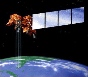
Landsat is the programme for the observation of the earth's surface. Landsat is the oldest United States programme. Seven Landsat satellites have been launched since July 1972. The last among them, Landsat 7, marked a new direction in the programme to reduce the cost of data and to increase the global coverage of the Earth with a view to research on global change.
Orbital data
Landsat satellites 4, 5 and 7 orbit at a mean altitude of 705 km in quasi polar circular orbits with an inclination of 98.2° (allowing heliosynchronism). One orbit round the Earth takes 98.9 min., so they complete 14.5 revolutions per day. One complete orbital cycle lasts 16 days.
These orbital characteristics affect image acquisition:
- coverage is complete between the 81° north and south parallels.
- image coverage increases with latitude (7% at the equator, 54% at 60° latitude).
On-board systems
The on-board instrumentation evolved with each satellite, from the RBV (Return Beam Vidicon) camera and MSS (Multi Spectral Scanner) in 1972 to the ETM+ radiometer (Enhanced Thematic Mapper Plus) in 1999.
The spatial resolution went from 80 m to 30 m (or 15 m in panchromatic mode) and the spectral domains explored are in the visible, near and middle infrared and thermal infrared regions.
The ETM+ radiometer makes it possible to have images covering a field of observation of 185 km * 185 km with a spatial resolution of 30 m in multispectral mode.
 Landsat
Latest
Fill out my online form.


